About Kilimanjaro

Mount Kilimanjaro is the tallest mountain in Africa. It stands an impressive 19,341 feet tall over the Tanzanian plains. Mount Kilimanjaro is also the tallest free-standing mountain in the world, meaning it is not part of a mountain range (such as Mount Everest and the Himalayans).

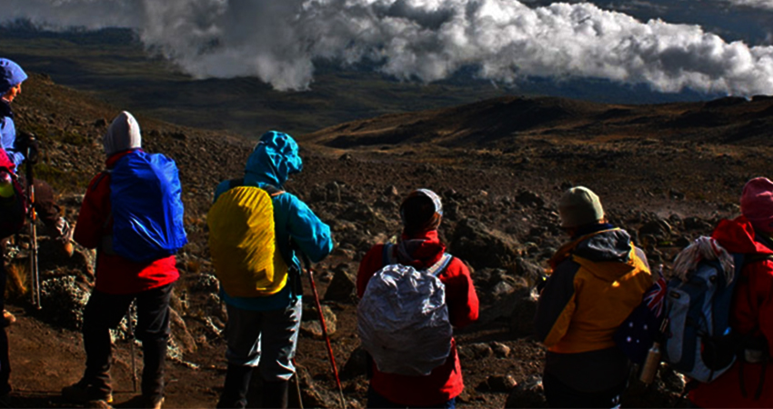
Many people climb Kilimanjaro every year. The activity is not just for hard core backpackers and experienced mountaineers. Everyday people, including accountants, engineers, food servers and teachers, successfully reach the top. Children as young as 6 years old and seniors as old as 82 years old have done it. Experts agree that anyone who is in average physical shape can climb Kilimanjaro, which is why the mountain is so popular amongst the general adventure seeking population. No technical mountaineering ability is required.

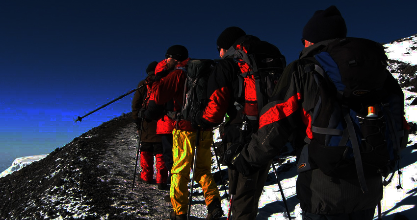
There are six major routes on Mount Kilimanjaro. Each is well maintained, and each route has different pros and cons. Foot traffic on the routes is regulated by the Kilimanjaro National Park Authority. It is required to have a guide while trekking on Kilimanjaro, and there is no shortage of guide operators who can take you to the summit.

The weather on the mountain varies widely depending on the elevation and season. It can be extremely cold near the summit, so warm, windbreaking clothing is a necessity. Heavy rain is also possible at any time, so quality waterproof gear is mandatory. All climbers should be well equipped.

The best time to climb Kilimanjaro is during the dry season. January, February, July, August, September, October are the best months to go. The rainy season occurs during the months of March, April, May, June, November and December

RONGAI ROUTE

RONGAI ROUTE

The Rongai route on Mount Kilimanjaro is a seven-day camping route; it has the attraction of being a lower traffic and easier route compared to the southern slopes for climbing Kilimanjaro. It attracts about 10% of visitors to the mountain. The route is really a complete traverse, the only one to experience the arid northern side and the lush southern side. It's also known as the Loitokok Route.

Starting from the Kenyan side of the mountain in the north its advantages are a more gradual and easier route in terms of terrain, plus there are excellent clear views of the mountain all through the approach. There is also more opportunity to see wildlife such as buffalo, elephant and antelope.

The seven days includes a day of acclimatisation at Mawenzi Tarn and this is an important addition because the flatter terrain means you can't 'climb high, sleep low' which is a good approach to acclimatization. This extra day helps a lot and means the summit success rate on this route is quite high at over 80%. A six-day itinerary without the acclimatisation day lowers the summit success rate to about 65% and it's much more likely to get altitude sickness.

The route is quieter and flatter, and arguably has less scenic quality than other routes on the south side. However, walking across the open plain with the summit massif in view all the time gives a real sense of vastness to the mountain. It is drier because of the fact that the mountain itself stops the rain clouds coming up from the south, so it's really a very different experience in terms of scenery and terrain. For many, the solitude and sense of space is a big draw, although you don't get to experience all the different habitats which are evident on the south side routes like Machame and Lemosho.

It takes five days to ascend from the NNE through the forest and onto the heathland and to the last camp at Kibo where it joins the Marangu route. Summit day is on day six up to Gilmans Point on the crater rim and then up to Uhuru Peak and all the way down to Horombo Hut, and the seventh day is a descent to Mweka Gate which is just half an hour drive from Moshi.

We use top quality mountain tents, comfortable mattresses, and qualified guides who work with us full time, porters who carry the bags and equipment, and cooks who provide fresh food every day.

Frequently Asked Questions:

When is the best time to climb the Rongai Route?
Because this route lies in the rain shadow of the mountain and is drier, it's possible to climb the Rongai during rainy season as well as all other times of the year. Rainy season is April - May and October - December.

Is Rongai a busy route?
No, this route is less busy and more remote, but arguably less scenic than routes from the south side of the mountain. The Northern Circuit route does meet up with this route at the caves but you will only see other people from Kibo onwards.

How long is the Rongai route?
The total distance is 72 kilometres with the longest day being summit day at 21 kms. This route has an acclimatisation day at Mawenzi Tarn which helps with acclimatisation but there is less of the 'climb high, sleep low' option so we only do this route in seven days, which is the recommended number of days for a climb of this altitude.

What are the camps like on Rongai?
The camps on this route are less frequented and a bit more basic than the other routes but they all have toilet facilities and a Rangers hut. There are no huts, this is a camping route only.

Copyrights © 2022 Royal Tour Tanzania. All Rights Reserved